File:Mount Dennis, courtesy of OpenStreetMap Corridor Option 1b.jpg
From WikiAlpha
Size of this preview: 800 × 512 pixels. Other resolutions: 320 × 205 pixels | 951 × 609 pixels.
Original file (951 × 609 pixels, file size: 431 KB, MIME type: image/jpeg)
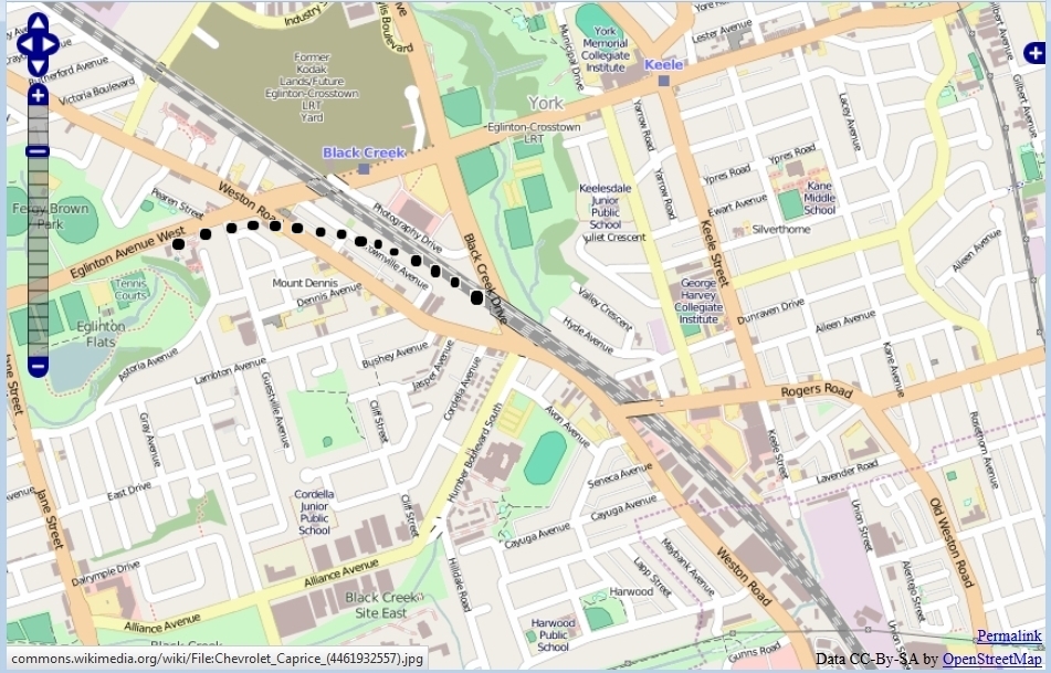
This map is a clip from an OpenStreetMap, generated by the OpenStreetMap site, which publishes under a CC-by-SA license, with dots, added by myself, that show my attempt to represent the curve at Mount Dennis of proposed route "Corridor Option 1b" of John Tory's "SmartTrack", where it leaves the traditional rail right of way to follow a new route along Eglinton.
I added the dots that represent the curve based on the map on page 4 of this pdf.
File history
Click on a date/time to view the file as it appeared at that time.
| Date/Time | Thumbnail | Dimensions | User | Comment | |
|---|---|---|---|---|---|
| current | 09:16, 15 June 2015 | | 951 × 609 (431 KB) | Geo Swan (Talk | contribs) | This map is a clip from an OpenStreetMap, generated by the OpenStreetMap site, which publishes under a CC-by-SA license, with dots, added by myself, that show my attempt to represent the curve at Mount Dennis of a proposal "Corridor Option 1b" of John |
- You cannot overwrite this file.
File usage
There are no pages that link to this file.