File:Athabasca Oil Sands map.png
From WikiAlpha
Size of this preview: 410 × 599 pixels. Other resolutions: 164 × 240 pixels | 1,200 × 1,753 pixels.
Original file (1,200 × 1,753 pixels, file size: 611 KB, MIME type: image/png)
Original caption:
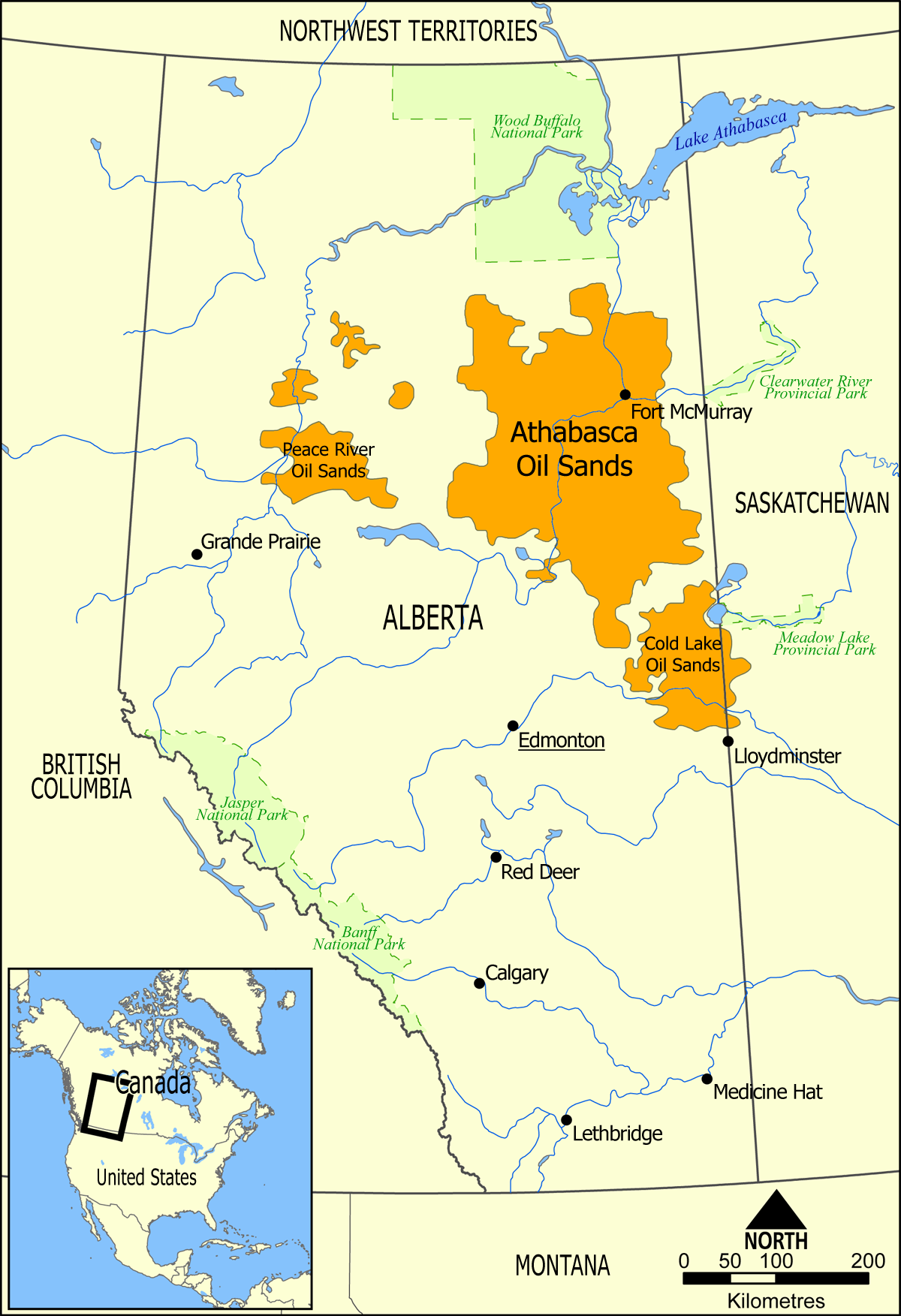
- This map shows the extent of the oil sands in Alberta, Canada. The three oil sand deposits are known as the Athabasca Oil Sands, the Cold Lake Oil Sands, and the Peace River Oil Sands.
Wikimedia commons contributor NormanEinstein created this map, uploaded it here, in 2006, and released it into the public domain.
File history
Click on a date/time to view the file as it appeared at that time.
| Date/Time | Thumbnail | Dimensions | User | Comment | |
|---|---|---|---|---|---|
| current | 23:49, 5 November 2012 | | 1,200 × 1,753 (611 KB) | Geo Swan (Talk | contribs) | Original caption: :'' This map shows the extent of the oil sands in Alberta, Canada. The three oil sand deposits are known as the Athabasca Oil Sands, the Cold Lake Oil Sands, and the Peace River Oil Sands.'' Wikimedia commons contributor [http://commons |
- You cannot overwrite this file.
File usage
The following 3 pages link to this file: